I will post photos tomorrow since we don’t have wifi at this location. I will highly recommend it, though: Katy Trail B&B. It’s owned by the author of the book we used to plan our trip, The Complete Katy Trail Guide Book, Brett Dufur. It’s adorable and comfy.
Today was another beautiful day, a little warmer, but dry air and clear. This section of the trail is supposed to have the most “rollers” but the grades are all gradual, if long. We have much steeper grades at home. Remember this is an old rail line, so it doesn’t have grades trains can’t handle. As soon as we left Booneville, where we stopped for lunch, it was flat as a board.
The most treacherous dangers on this trail so far are walnuts and squirrels. I can’t understand what they must be thinking, “Hmmm, something is coming towards me. Do I jump into the tree, or do I run out in front of that thing coming at me?”
When we got to a part of the trail that was between farm fields and in the sun, we found a grasshopper plague. They seemed to fly right at us, too.
Best wildlife moment of the day was a Coopers Hawk grabbing a large vole not 5 feet in front of us and flying up to a tree branch. We were glad we didn’t scare him badly enough to drop his lunch!
For me, the hardest part today was the bridge over the Missouri River. As I’ve already established, I hate heights. I’ve been ok with the trail bridges because they are pretty enclosed. This bridge was a pedestrian bridge alongside a highway. The problem for me was that the roadbed and the wall were not connected, so there was a sizeable gap. For some reason, that FREAKS me right the heck out. No idea why, but it does. But I made it! (did I mention The Missouri is really, really wide?)
 |
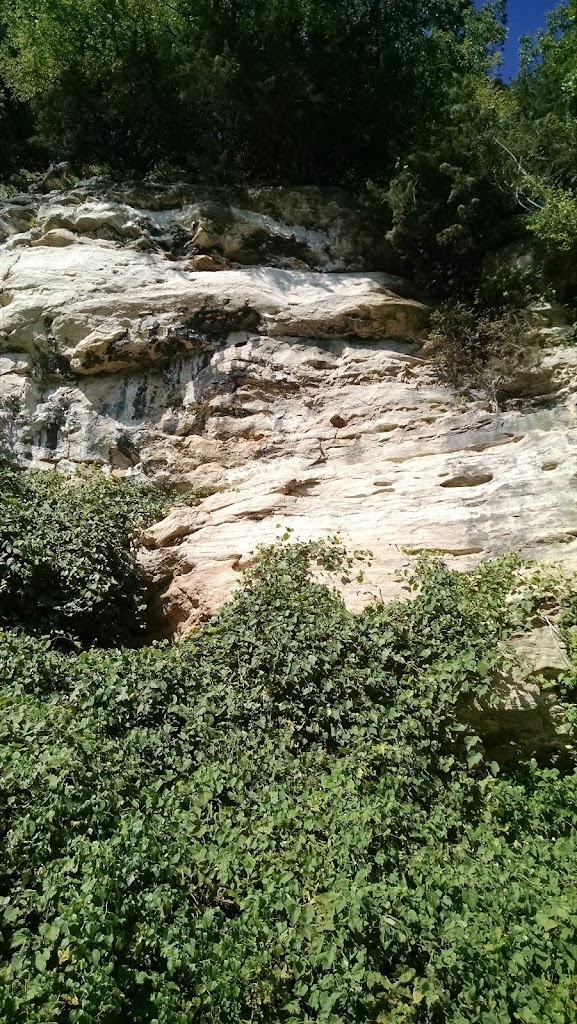
| Limestone Bluffs |
 |
The original rail tunnel
into Rocheport |
Coming into Rocheport was beautiful! The city is aptly named after the rocks here (“roche” is French for rock). We started seeing rock cliffs to our left, or north, about 10 miles out. There were amazing formations, with visible grottos. A lot of today’s trail left me daydreaming about what it must have been like back at the turn of the last century. This is also Daniel Boone country. It’s some pretty rugged country and tough to imagine what it must have taken to cut through it without trails or reliable maps.
We had our parents drive to Les Bourgeois Vineyards for dinner. What an amazing place! Gorgeous terraced patios overlooking The Missouri River. It wasn’t that far away, but very steep up to a high point on the cliffs, so driving was a good choice. We decided it’s probably good we don’t live nearby or we would be here waaayyy too often!
 |
| The spectacular view at dinner |
Tomorrow is a shorter day, but kind of the test, since we’ve not done this much distance more than 2 days in a row before. We’re definitely tired, but nothing is bad. I’m glad I spent time really making sure my equipment is all set up right. I changed my seat back to my old one after the trip from Richmond to Muncie and back, which was a good move. The last thing you want on a tour is seat trouble, because once it starts, the only real solution to heal it is time off. The only thing we’re both contemplating is new, more upright handlebars. Shoulder fatigue is our biggest problem, so far.
 |
| “Pony Truss” style bridge |
 |
| “Through Truss” style bridge |
 |
| Add caption |
 |
| Booneville Depot/Chamber of Commerce |
 |
| Lunch!!! |
 |
| Old Katy Roundhouse (remnants) |
 |
| Daniel Boone Commemoration |
 |
Plaque at Daniel
Boone site |
 |
| Sitting room in the B&B |
 |
The awesome Katy Trail B&B – kitchen
perfectly stocked for a cyclist’s breakfast |


